It’s a long-time myth that Boston’s roads are a labyrinth because the roads are based on cow paths from when the city was first built. The city’s tangled web of roads can be frustrating on an average day, and during special events, like the New England Patriots’ Super Bowl victory parade, it can be downright impossible to get from one side of the city to another in a reasonable amount of time. It’s no wonder that city traffic managers are looking to outside resources to alleviate the worsening congestion in the tangled web of roads.
The city of Boston reached out to Waze, a Google-owned driving app that allows users to report slow moving traffic, road construction, and even where cops are located. The city shared the parade route on Waze, and as a result, users were able to avoid the traffic, which hopefully helped the city-wide traffic congestion, according to Wired.
The success of that one-time data share has lead to a longer-term relationship between Waze and the city of Boston. On February 13th, the two made it official: Boston will inform Waze about any planned closures, and in exchange, the app will give the city’s traffic management center access to its constant stream of user reported data. This crowdsourcing of information will work two-fold: in the short term, the city will be quicker to respond and alleviate traffic problems as they occur, and in the long-term, Boston hopes that the data will help traffic managers perfect the timing of traffic lights and prevent back up in the city’s winding network of roads.
Prior to the announcement, Boston’s Traffic Management Center was working manually to help regulate the flow of traffic, and while it used an extensive system of traffic cameras and magnetic sensors, it was limited in its ability to respond quickly to all situations. For example, if a car or truck is broken down on a side street without cameras and not the magnetic coils, it might take hours before the city is able to respond and update the traffic lights accordingly. With Waze, however, users will report immediately on the app what is happening, and the city can respond almost instantenously.
Waze can also alleviate the issue of snow-covered roads. “When you have 20 percent of a travel lane covered in snow, these create pinch points. We can see those on our cameras and push those to our Waze users,” Gina Fiandaca, the city’s transportation commissioner, told Wired.
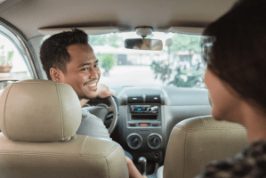
From a broader perspective, Franklin-Hodge wants to prioritize bus traffic and improve public transportation in order to ease city traffic overall. This is part of Mayor Martin Walsh’s plan to make Boston a more tech-forward city. The city recently launched a parking app called ParkBoston, which lets users pay for meters from their phone. And last month, Boston announced that it would collaborate with rideshare service Uber to analyze larger scale driving patterns based on the distance and time duration of people’s rides.
Data-sharing systems are not perfect, of course, but in the long-term, Uber and Waze may help fill in the gaps of Boston’s current traffic system and provide a model for other cities to adopt to solve the never-ending problem of traffic. Or, you know, people could take public transportation and solve traffic jams altogether.